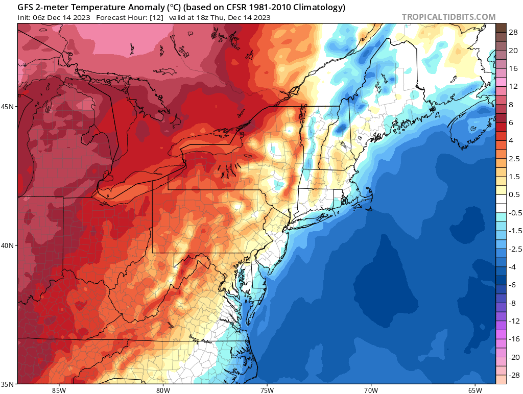
Winds shifted to the northwest late Wednesday dragging colder air southward into the region. Temperatures fell back to the upper 20s and lower 30s overnight, accompanied by a gusty northwest wind, and that’s where we’ve started our Thursday. Unfortunately, readings won’t move all that much today, despite a good deal of sunshine (there will be some scattered ocean effect cloud cover to start the day on the Lower and Outer Cape) throughout the daylight hours. We’ll generally see high temperatures in the lower and middle 30s across the Cape and it’ll feel a bit colder at times this morning as the busy northwest wind persists into midday. The average high for the day is 46F – so daytime readings will be a solid 10F or so below average.
As you can see from the temperature anomaly map posted above, while the air mass locally is a chilly one, temperatures off to our west are on the milder side (relatively speaking) – as indicated by the warm color shadings. That’s a good sign of what’s to come for us over the next 24 hours.
Northwest winds this morning will become westerly over the course of the day today, signaling the departure of the chilly air mass and the arrival of milder air from the west. With that in mind, we can expect a much milder day on Friday with highs nearing or passing 50F.

