Month two of meteorological winter is upon us and it’s time to start thinking a bit more about cold and snow.
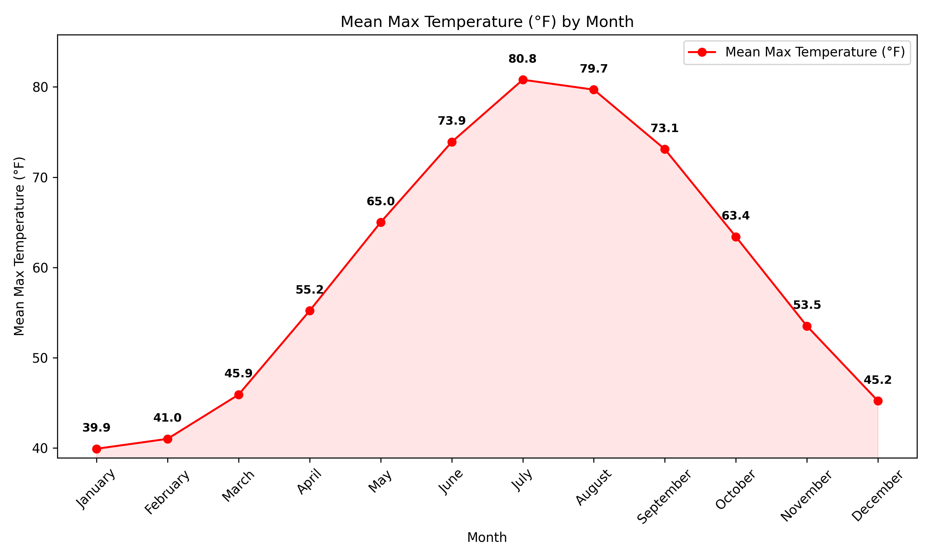
As we head through the month of January, temperatures continue their annual trend downward – reaching their average minimum during the second half of the month. The average high January 1 is 42F at Hyannis and that value continues to dip through the first couple of weeks of the month, before leveling off at 39F during the second week of the month and holding there into the beginning of February. Average nighttime lows are in the 20s (about 25F and 23F respectively). Of course, these are long-term averages and the month can have huge extremes. Temperatures near 0F are possible…as are daytime highs near 60F.
As for precipitation, January tends to be slightly drier than December as colder/drier air infiltrates the region from the north. The long-term average is 3.9 inches (versus 4.68 in December). And of course, some of that precipitation can come in the form of snow. While snowfall records are not officially kept on the Cape, an “average” January would yield about 7 or 8″ of total snowfall.

