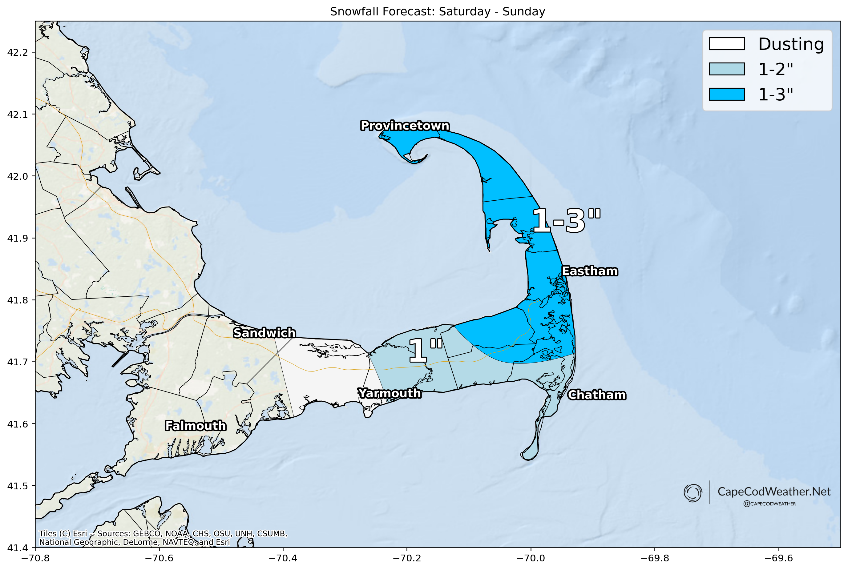
Bands of ocean effect snow will move over the Lower and Outer Cape tonight, producing some brief bouts of heavier snow and likely some pockets of tough travel / low visibility. Generally an inch or so of additional snowfall is expected from about Dennis eastward by Sunday morning, but should a band of heavier snow organize, a couple / few inches of snow is certainly possible. High resolution model guidance does show a few streamers of ocean effect tonight, which is typically a good signal for some heftier bands of snow to organize. Monitor the radar.