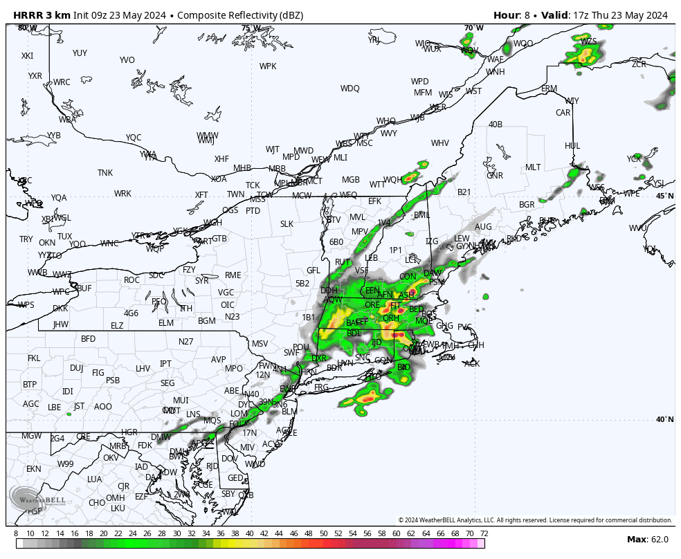
A cold front moving into the region will set off numerous showers and thunderstorms across Southern New England today and first thing tonight. There’s enough upper level support to carry some of this activity to the coastline today and higher resolution model guidance does show some showers/downpours/thunderstorms marching eastward into the region during the midday and early afternoon hours. Any storms that do fire off could produce some gusty winds and small hail and of course lightning is always a hazard. Monitor the radar through the day. The frontal zone responsible for the wet weather threat will push offshore tonight, setting us up for a really nice Friday with increasing amounts of sunshine and unseasonably warm temperatures.