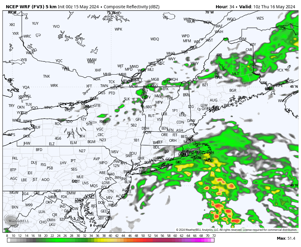
Low pressure over the Mid-Atlantic will shift eastward and wobble offshore over the next 24 hours. The position and subsequent slow track of the weather system will put Southern New England on the northern edge of the storm’s precipitation shield today, tonight and Thursday. Consequently, we can expect moisture (initially in the form of just cloud cover) to gradually advance toward our area today, with skies trending overcast as the day goes on. Tonight and Thursday, moisture will deepen and showers and drizzle will develop around the area. Model guidance is somewhat split on the coverage and extent of rainfall – with some guidance keeping the brunt of the steady rain just barely to our south and limiting precipitation locally, while others are far more robust and yield a solid 1/2 to 1 inch of rain from late tonight into Thursday. In either case, we can expect damp and cooler conditions later tonight into Thursday. Precipitation should slowly decrease in coverage during the day on Thursday, with very slow improvement expected during the afternoon. Unfortunately, easterly low level winds are likely to persist for the following few days, ensuring a cool stretch of weather.

