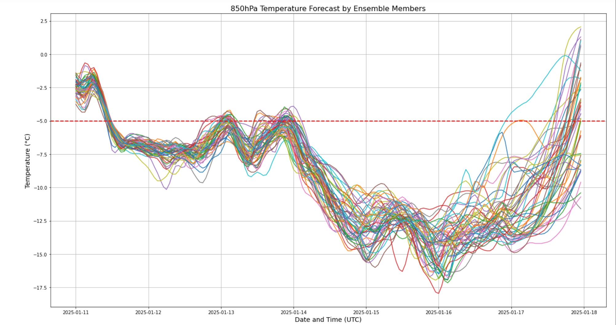
After a week of cold (which included a fairly lengthy stretch of sub-freezing temperatures), readings have moderated in time for the weekend (though still chilly) and will remain near average levels through Monday. However, another surge of modified arctic air is going to drop into the region in the upcoming week, yielding another round of wind and cold Tuesday through Thursday – very similar to what we just dealt with. You can see on the chart above – temperatures aloft (850 mb = 4500-5000′ above ground) taking a nose-dive Tuesday to well below average levels (dashed red line).

