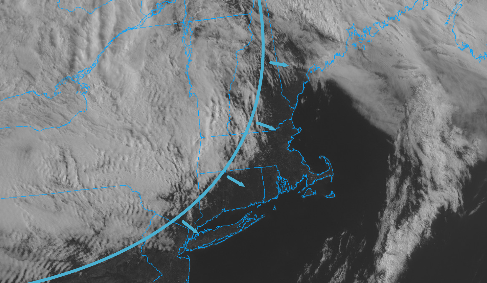
A dry, mild westerly breeze developed overnight and kicked Saturday’s moisture out to sea. The westerly flow of air downslopes off the hills of New England and helps suppress cloud development. So while Sunday morning’s visible satellite imagery shows thick cloud cover over New York State and northern parts of New England, hardly a cloud is to be found in Eastern Massachusetts and that’ll be the general theme through midday today. Expect sunny skies, temperatures in the 60s and a busy westerly breeze. Unfortunately, the nice spring conditions won’t hold through the entire day. The cloud cover to our north and west is associated with a pocket of cold air aloft rotating through the Northeast and that colder air high in the sky will eventually allow clouds to develop and fill the sky across most of the region. As we push into the afternoon clouds will become more and more prevalent around the area and eventually skies will trend toward mostly cloudy later in the day. A spot shower can’t be ruled out.