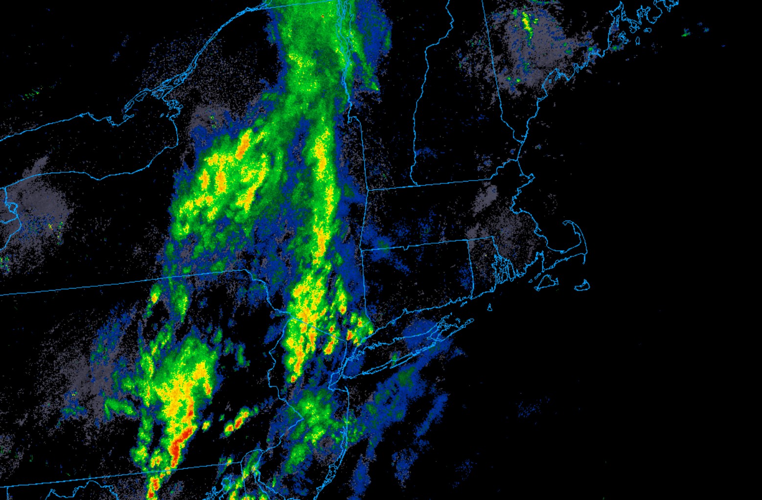
Monday’s cool, dank easterly flow of air is sloooowly giving way to southerly winds and a milder and more humid air mass today. The wind switch and air mass change comes courtesy of a warm front lifting northward over the region. That warm front is sitting right overhead this morning and will gradually inch its way to our north today, forced to move along out ahead of a cold front pushing eastward through the Northeast. That cold front will cross through the area today and tonight, bringing with it the threat for some shower activity later today. Guidance has been hinting at a round of wet weather during the midday and afternoon hours, with hit or miss showers and some embedded downpours and rumbles of thunder. Keep an eye to the radar. Behind the “cold” front, much much nicer weather will take hold tomorrow and Thursday…with sunny skies and temperatures in the 70s and lower 80s. You can see the frontal zone nicely on the regional radar this morning, depicted by a band of north to south aligned showers across the Northeast.