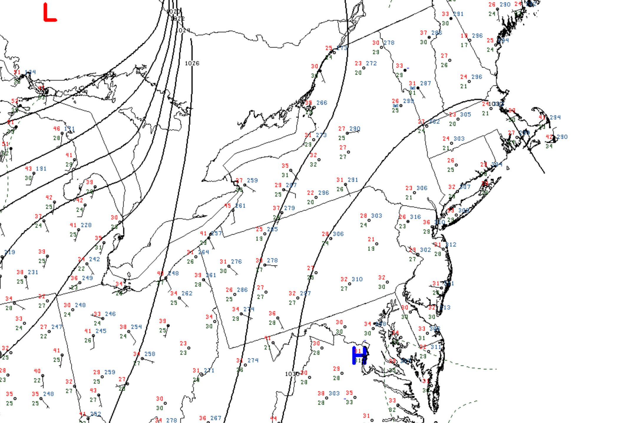
The Wednesday morning surface analysis shows high pressure centered over the Mid-Atlantic, extending northward into Southern New England. Beneath this high pressure cell, clear skies and light winds have yielded yet another abnormally cold November morning across the region, with widespread 20s and 30s extending from the Mid-Atlantic into Northern New England.
Here on the Cape, just to the east of the axis of high pressure, a light northerly wind persisted overnight and continued to push batches of cloud cover across the area (and a period of light rain and drizzle during the first part of the night). The result was a relatively milder overnight period compared to the remainder of the Northeast, with readings holding closer to 40F.
Today marks a day of transition in the weather pattern. The aforementioned area of high presssure to our south will push offshore and the clockwise flow of air around it will allow southwest winds to become established across the area (ote the southerly flow of air developing over the Great Lakes and Ohio Valley – indicative of the return flow.) Consequently, today will be the last of the chilly days for this week as noticeably milder air will build northward into the area over the next 24 hours. Both Thursday and Friday should see afternoon temperaturs near 60F.