A powerful winter storm – bringing a blizzard to parts of the Great Lakes and Midwest – will pass west of our area over the next 24 hours, resulting in another period of rain, with embedded wind-driven downpours.
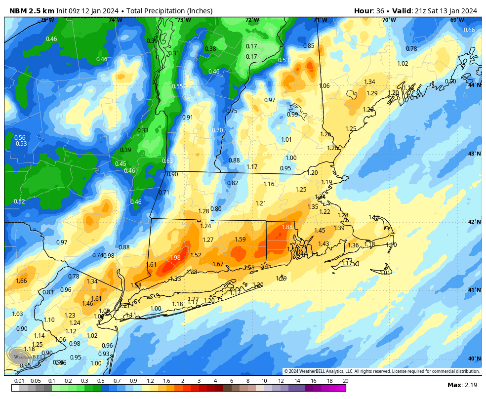
Rain: Precipitation will develop very late tonight and become heavy toward morning. Moderate to heavy rain will continue through Saturday morning, before tapering down sometime in the late morning time frame. Another solid soaking rain of at least an inch is expected across the area, with some spots again likely nearing 2 inches of rainfall. Some pockets of street flooding are possible and it will certainly be rather nasty if you are out and about during the first part of Saturday.
Wind: Light winds today will become a freshening east and southeast breeze tonight and continue to increase through the nighttime hours. As we approach dawn and move through Saturday morning, strong southeast winds on the order of 25 to 35 mph are expected with gusts of 45 to 60 mph moving through the area. Similar to the last few times this has transpired, we are likely to see some isolated to scattered tree and limb damage and some power disruptions. Things will taper down during midday before a gusty southwest wind develops during the afternoon.