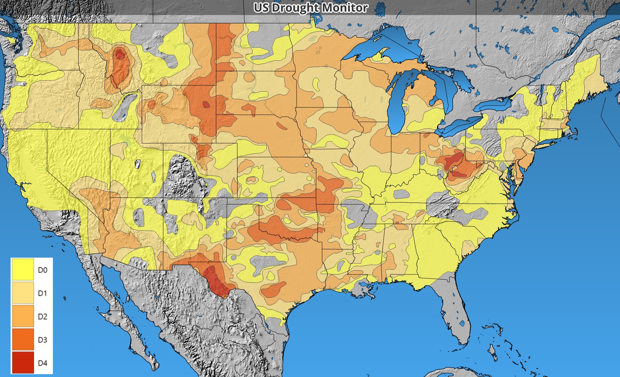
The latest US Drought Monitor has come out and dry conditions extend from coast to coast and border to border. Here is the official summary: “The dry pattern that has been impacting much of the country has continued into this current period. The wettest areas were along the coast in the Pacific Northwest, with some locations recording over 2 inches of rain for the week. Other areas receiving some precipitation were in the Four Corners region, the Midwest and parts of the South, but many of these totals were minimal and did little to impact the drought conditions. The Southern Plains and South were the warmest regions, with departures of 10-12 degrees above normal this week. Almost the entire country was warmer than normal, with only areas of the Northeast and Pacific Northwest having near to slightly below normal temperatures. As the month is ending, many locations will be at or near record dryness across the country. For the Lower 48 states, there has not been this much drought shown on the U.S. Drought Monitor since December 2022. Areas of the Southeast that were impacted by significant precipitation associated with landfalling hurricanes have dried out rapidly, with some locations recording zero precipitation since the hurricanes. Some precipitation development at the end of the current period could help ease conditions into the next week, but that will be determined on the next map.”

