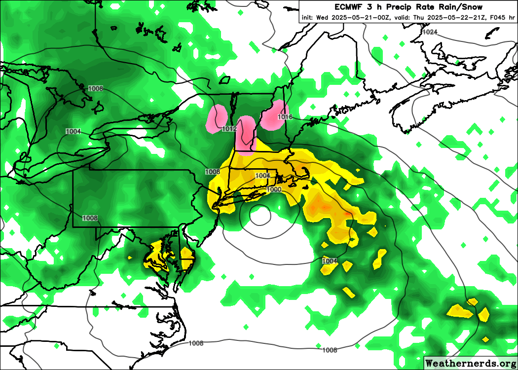
A compact coastal low will develop off the Mid-Atlantic coast later today and approach Cape Cod on Thursday, setting up a classic (late-season) nor’easter for Cape Cod, the Islands and the rest of Eastern Massachusetts.
Rain
- Widespread 1–2 inches.
- Expect poor-drainage street flooding and ponding on roadways.
Wind
- ENE 20–30 mph, gusting 40–50 mph around the area; a few outer-Cape/islands spots could touch 55 mph.
- Fully leafed trees raise the risk of scattered limb damage and isolated power outages.
Coastal Impacts
- Evening high tide (8PM Barnstable Harbor, 10 ft) yields some beach erosion and pockets of minor coastal flooding thanks to a 1–2 ft surge and wave action…mostly on north- and east-facing beaches.
Bottom Line
Plan for a raw, wind-drive rain throughout most of the day: allow some extra travel time for the evening drive and don’t be surprised to see some short-lived power issues. Conditions gradually improve by early Friday.