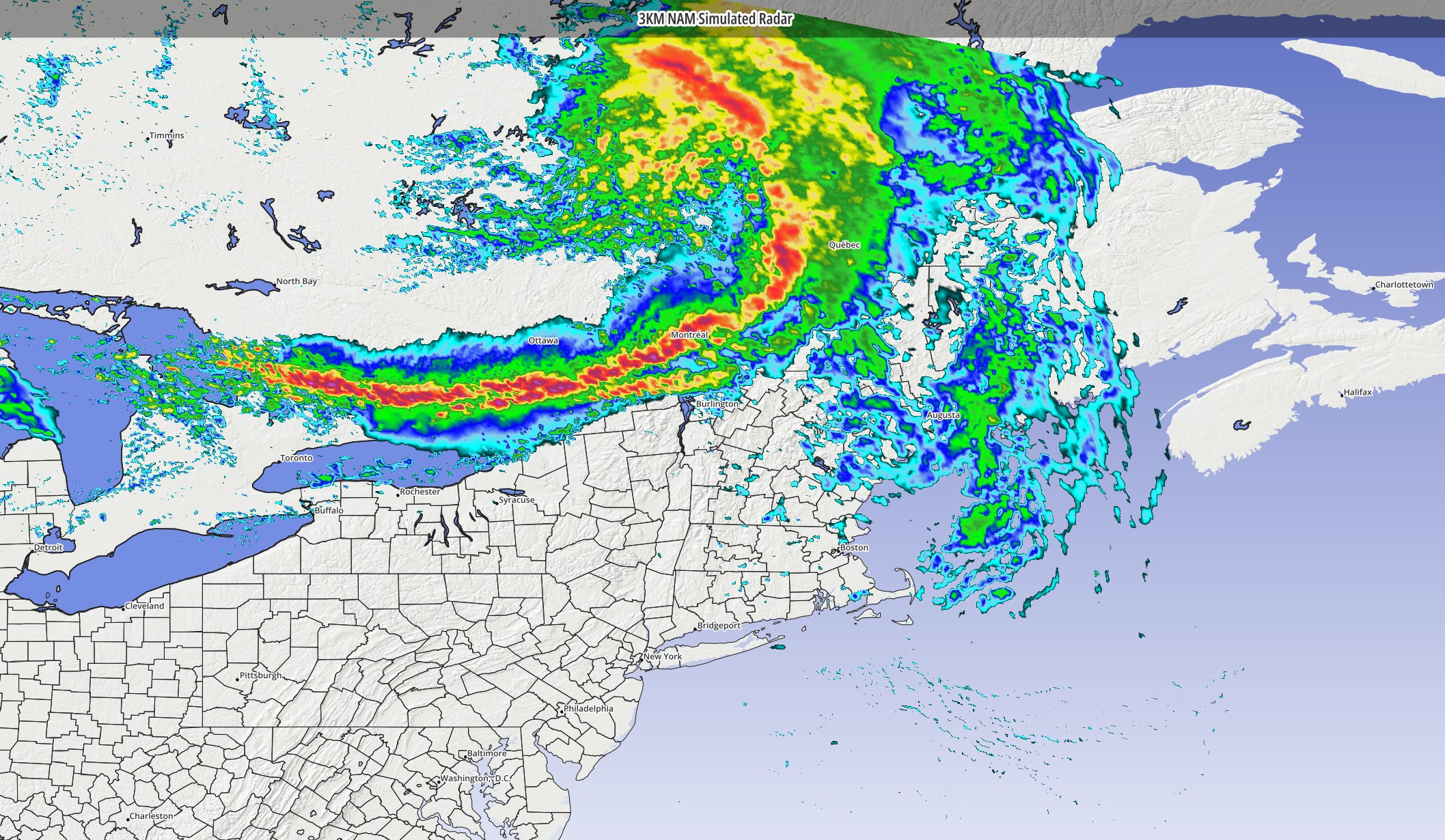
A large MCS (mesoscale convective system) that plowed through the Northern Plains last night (producing tornadoes and straight line winds in excess of 100 mph) is pushing through the Northern Great Lakes today and will head eastward toward Quebec and northern parts of New York State and New England tonight.
Model guidance has keyed in on this feature for several days, suggesting it would sweep by our region Sunday morning…maybe swiping us with some shower or thunderstorm activity… but also sort of kicking off our heat wave as hot weather moves in behind it.
The feature’s exact path and intensity as it passes our region remains a key detail to be ironed out and will have big implications on our actual sensible weather. Historically, these complexes of thunderstorms produce fast-moving squall lines with lots of vivid lightning and strong winds…and this feature is likely to do the same. The question is just where exactly this travels. Whether we are greeted by a nasty thunderstorm, a quick shower or just a wind shift really won’t be known until the last few hours leading up to its passage.
Monitor the radar and BlueSky.