We’ll squeeze in a decent day on Sunday – partial sunshine (more in the way of clouds as the day goes on) and temperatures recovering to the 40s after a chilly morning. Variable winds will become a southerly breeze during the afternoon and evening. Conditions will gradually go downhill tonight, with increasing clouds, the threat for a sprinkle or shower and a gusty southerly wind developing – signaling the arrival of a strong storm expected to impact the area Monday into Monday night.
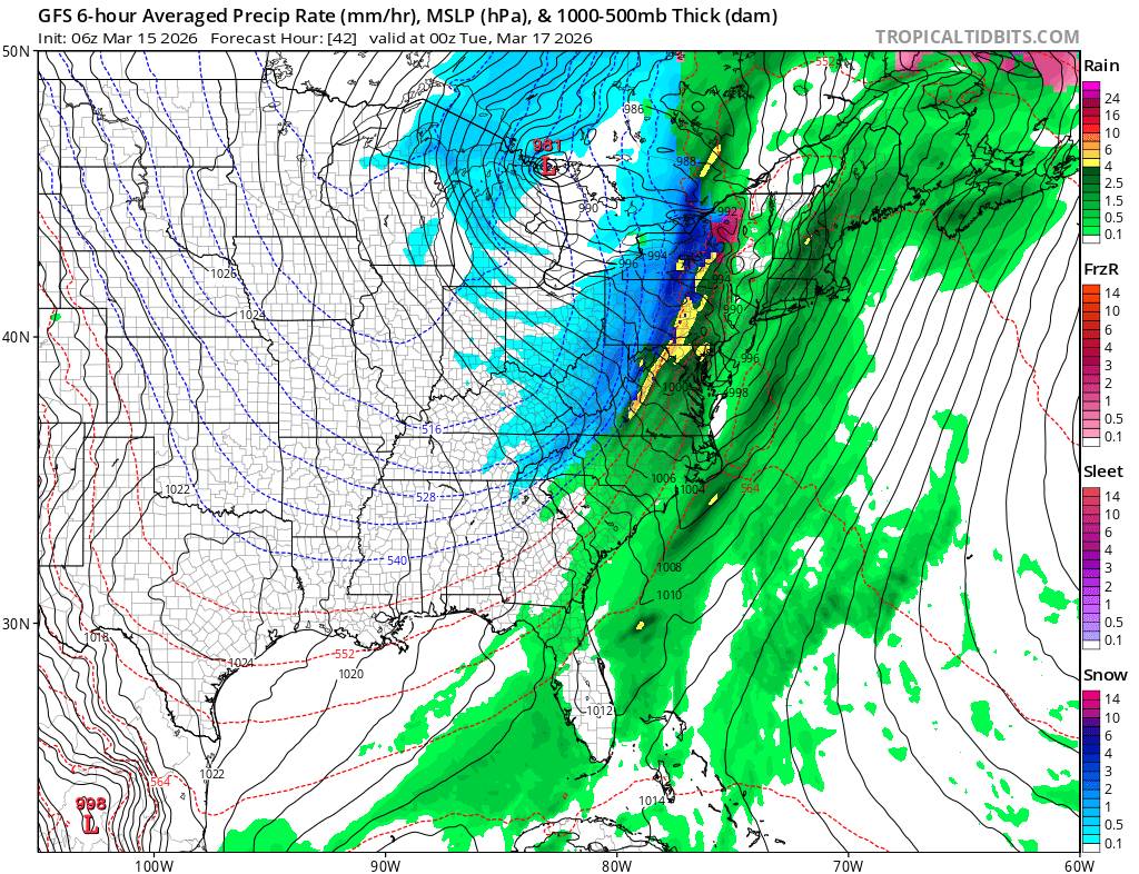
Powerful low pressure moving through the Great Lakes – delivering a historic spring blizzard to the northern Great Lakes – will swing a strong cold front through the eastern US Monday into Monday night. Out ahead of that frontal zone, widespread rain, thunderstorms (significant severe weather over the Mid-Atlantic) and strong southerly winds will impact the Mid-Atlantic and Northeast. For us here on the Cape, the worst of the storm will be Monday night when showers and downpours will combine with southerly winds of 20 to 35 mph with frequent gusts to 40 to 50 mph…and isolated gusts to 60 mph…to create rather nasty weather conditions. Expect a bit of tree and limb damage (and resultant power disruptions) around the area, thanks in large part to leftover hanging debris from our late February blizzard.
Conditions will improve on Tuesday but colder temperatures will take hold.