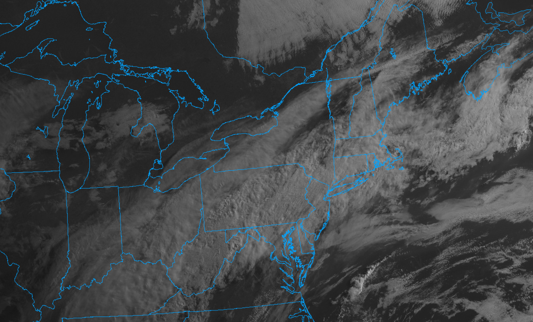
A cold front cut across the area on Wednesday and pushed offshore to the south last night (accompanied by some showers and a few rumbles of thunder). That frontal zone is slowly making its way further southward today and in its wake we’ve been left with gray skies and much cooler temperatures. Satellite imagery Thursday morning showed an expansive area of clouds extending from the Ohio Valley to Southern New England, while radar imagery showed a few additional patches of sprinkles and showers scattered about the region.
So all-in-all, expect an abundance of cloud cover today as well as the threat for a morning shower or two. Temperatures will hold in the lower 60s – some 15 to 20F cooler than Wednesday.