The mild and increasingly moist air mass over the region has yielded a bit of a murky start to our Thursday (in spots). With temperature and dewpoint values converging in the lower and middle 60s, low clouds and fog developed overnight and became locally dense, bringing visibilities down under 1/4 mile. As the sun starts to rise higher into the sky this morning, temperatures will creep upward and the fog will start to mix out.
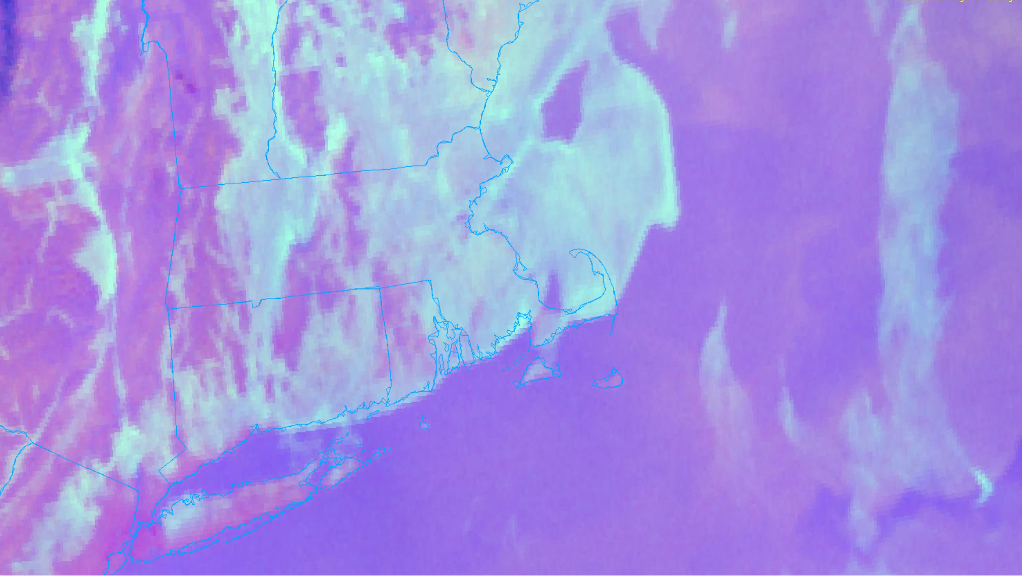
The low cloud cover / fog can actually be seen nicely on nighttime satellite imagery. The image above is the Nighttime Microphysics product. The College of DuPage provides this written description of the product: “The RGB Nighttime Microphysics product is a combination of three different infrared bands. It is useful for discriminating between different cloud types, especially between low stratus clouds and fog. The ‘Red’ channel is a difference of ABI bands 15 and 13, while ‘Green’ is a difference of bands 13 and 7, and ‘Blue’ is solely being represented by ABI band 13. This product is only truly useful during the nighttime when it is dark because of the influence solar reflectance has on band 7.”