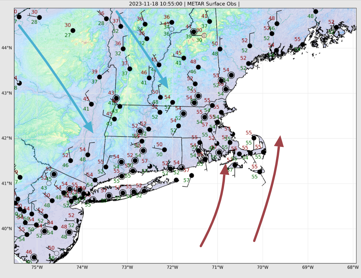
Surface observations around New England tell the weather story nicely this morning. Here on the Cape, we’re starting the day in the 50s with light southerly winds. We had a few showers overnight and skies are generally gray this morning. It’s actually a little damp/murky/muggy.
Meanwhile, off to our north and west, southerly winds have switched to the northwest and chillier, drier air is advancing south and eastward behind a cold front. Temperatures are falling through the 30s across most of New York State and into Vermont and Northern New Hampshire, indicative of the new airmass poised to move into our area over the next 24 hours.
The cold front currently situated to our west will press eastward through the morning hours and should push offshore during the afternoon (current short-term model guidance suggests a frontal passage around noontime – likely accompanied by some showers – with gusty northwest winds kicking in by 1 to 2PM). It’ll take a while for the colder air to displace the existing warmth over the area so we’ll squeeze in one more mild day today, with highs between 55 and 60F. However, you’ll notice the change in the air mass by the end of the day.
Readings will drop down into the 30s tonight and Sunday will be a much cooler and drier day.