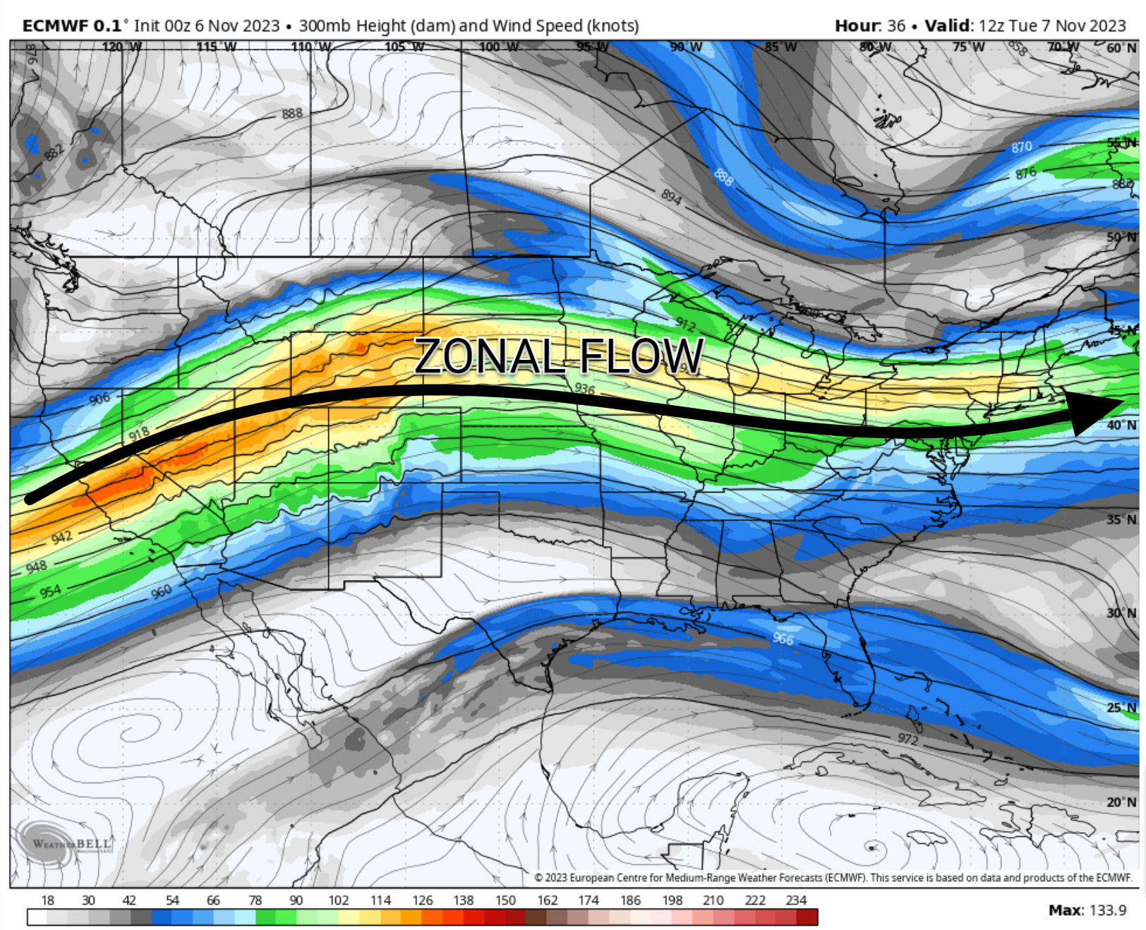
The image above shows forecasted wind speeds at about 30,000 feet above the ground tomorrow morning. Notice the general west to east flow cutting right across the country. This is a perfect example of a “zonal jet” and this jet stream configuration is expected to persist through the week.
In a weather pattern such as this, it’s fair to expect relatively quiet weather – or at least a lack of big storms.
A zonal jet stream generally prevents the sharp temperature and pressure gradients that we normally see with a “meridional jet stream” or north-to-south / south-to-north flow of air. Those sharp gradients are the key to storm development and are certainly more common in the Fall and Winter months.
Instead, the fast west to east flow usually results in quick-moving moisture-starved frontal passages. And that will be the general theme for the week ahead. We’ll track numerous fast-moving frontal systems but none of them will come with widespread heavy precipitation and the temperature changes ahead and behind them won’t be overly dramatic.

