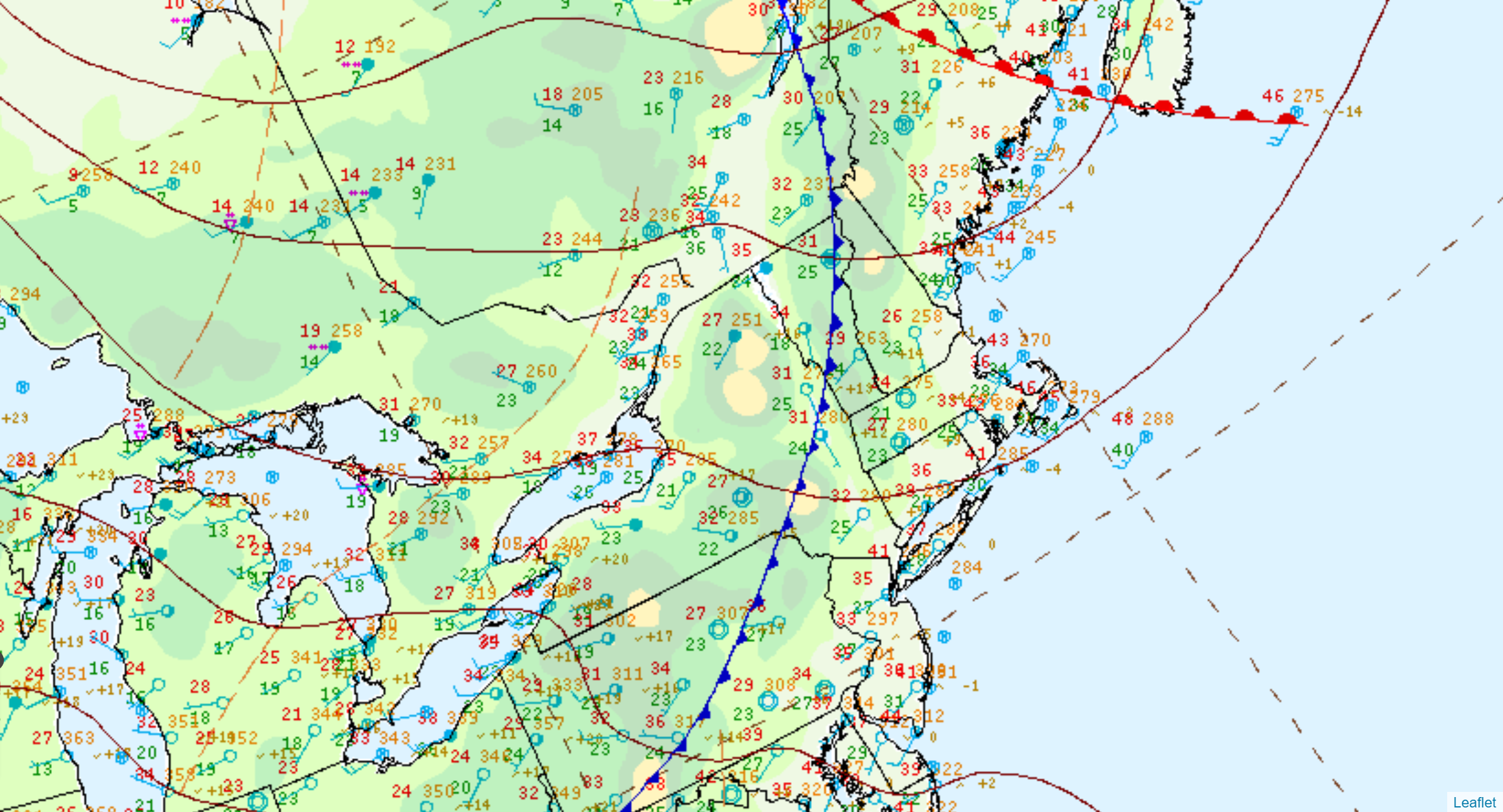
Surface analysis this morning shows a weak surface cold front draped across New England. Out ahead of the boundary, winds are from the southwest and temperatures are in the 30s to lower 40s to start the day. Behind the front, temperatures aren’t all that much colder, with readings generally in the upper 20s and 30s.
However, further to our north and west, over Ontario and Quebec, deeper cold is lurking, with temperatures Wednesday morning mostly in the 10s. This air mass is headed southward and will pay us a quick visit tonight and tomorrow, before exiting seaward Thursday night and Friday.
As for today, the combination of the mild start, a westerly breeze and little in the way of cloud cover will mean a mild day around the area. We can expect highs in the 45 to 50F range with a fair amount of sunshine/blue sky. A win for mid-December.
Later in the afternoon, winds will bend around to a more northwesterly direction, signaling the arrival of that deeper cold air and temperatures will start to slide backwards. After sundown, readings will fall back into the 30s and temperatures will continue to head downward overnight, accompanied by a gusty northwest breeze. By morning, we should be in the 20s to near 30F and temperatures will struggle to climb all that much on Thursday.
Other than a slight chance for a passing flurry tonight, dry weather will prevail through the end of the week.