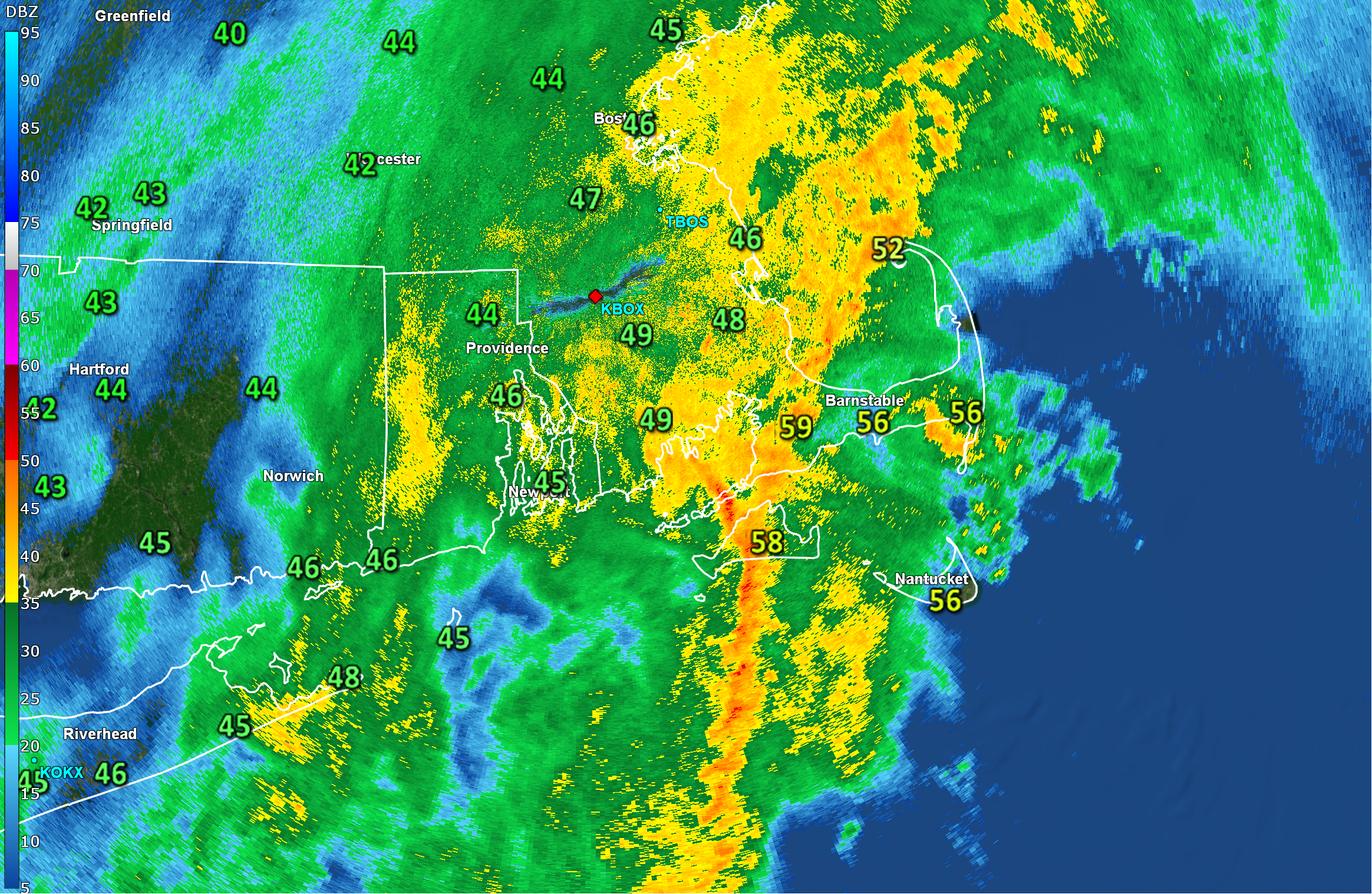
A strong cold front (and a series of low pressure centers riding along it) is marching eastward through the region this morning. Out ahead of this front, a large swath of rain, with embedded downpours, is crossing the area. Radar at 6AM showed most of the region covered with wet weather, with the heaviest rain approaching Cape Cod.
With that in mind, we’ll start our day on the ugly side, with downpours and strong gusty southerly winds. The worst of the rain and wind will coincide with our morning commutes/drives/routines – making for a rather miserable start to the work week. Expect some standing water on area roadways thanks to some very heavy rain and there could be a few pockets of tree and limb damage as strong winds persist.
Thankfully, the storm is moving right along and the wet/windy weather will not stick around for too long. By midday, precipitation will be tapering off across the Cape and winds will have shifted to the northwest and diminished.
As we move into the afternoon, colder but drier weather will establish itself over the region, causing falling temperatures but some partial clearing. Temperatures near 60F this morning will be closer to 40F (low/mid 40s) by your afternoon drive home.