A large, powerful storm center is impacting the Eastern United States today, bringing all kinds of hazardous weather from the Gulf Coast to the Great Lakes and Northeast, including heavy snow, damaging winds, heavy rain and severe weather.
While our Tuesday has started out clear, cold, frosty and snow-covered, giving the feel that a winter storm might be on our doorstep, the primary storm center associated with this large system is riding northward from the Mid-Mississippi River Valley into the Eastern Great Lakes, meaning our region will end up on the warm and windy side of this cyclone. Consequently, there’s no snow or ice to worry about over the next 24 hours. Instead, we’ll have to contend with yet another round of heavy rain/downpours and very strong south and southeast winds.
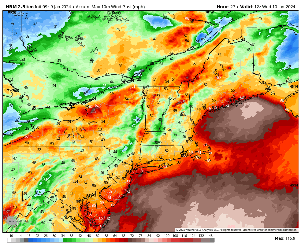
The worst of the weather will move in later tonight, with the peak of the wind and heavy rain arriving in the pre-dawn hours and continuing until an hour or two after sunrise. It’s during that time period that wind gusts in excess of 60 mph are likely around the area and torrential downpours will race through parts of the area.
It’s likely to be a very nasty morning commute around the area, with some tree and limb damage, power outages and plenty of street flooding in the typically prone areas.