It’s been a chilly stretch but thus far we have dodged the bitter cold arctic air that enveloped much of the nation over the last week or so. This weekend (unfortunately?) we get our taste of the cold as as a chunk of that arctic air mass has spilled into New England. Thankfully, the air mass has modified considerably so while it’ll be very cold – we won’t endure the truly frigid conditions that other parts of the nation had to contend with earlier in the week.
Temperatures Saturday morning were in the 10s across the Cape, with a gusty northwest wind sending wind chill values down into the single digits. Readings won’t recover all that much through the day today, with highs only between 20 and 25F. The wind will remain busy throughout the day, making it feel worse.
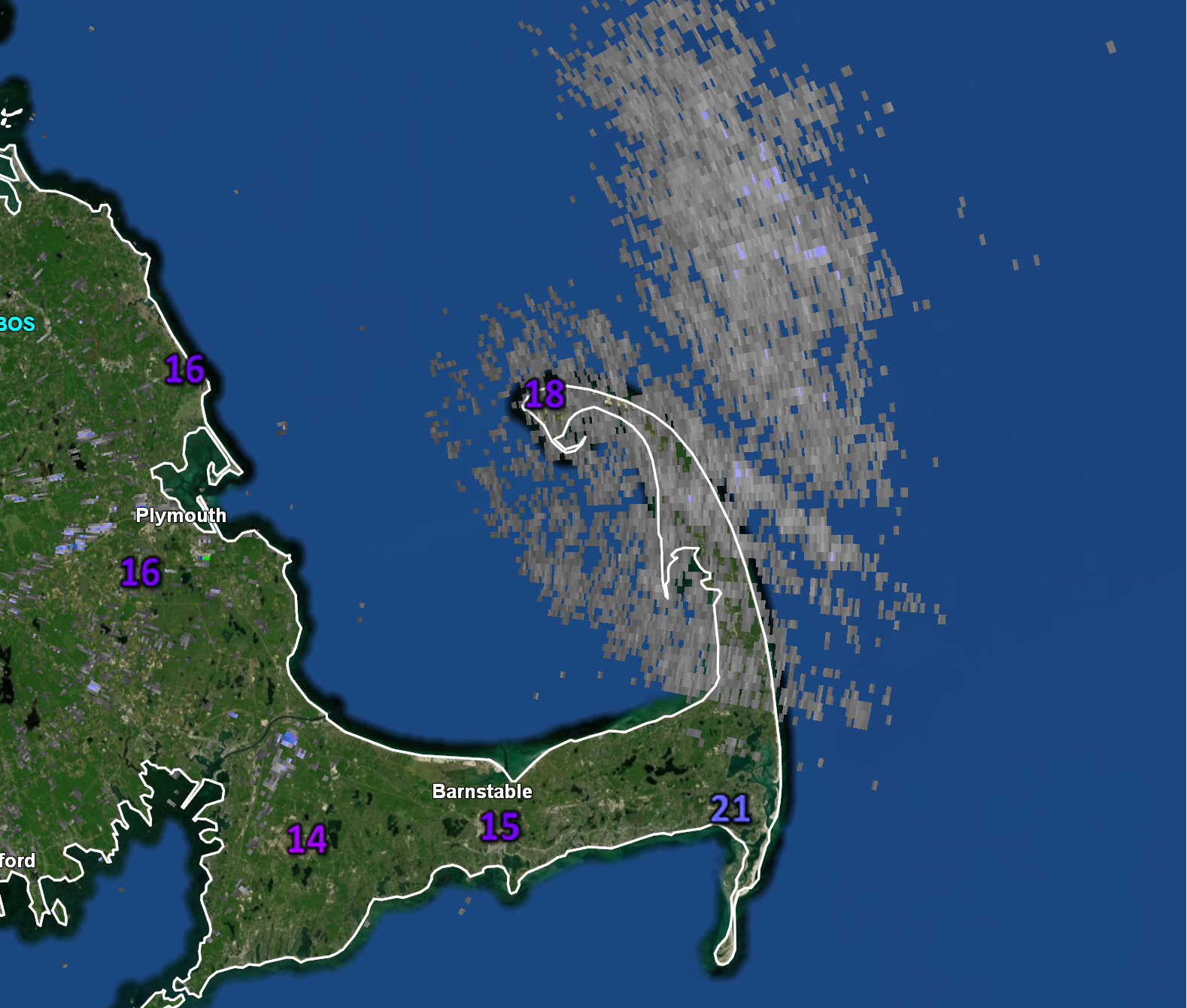
In addition to the cold, some off and on flurries and snow showers are expected throughout the day today and tonight, especially from Harwich, Brewster and Chatham northward to Provincetown, where a frigid wind off of Cape Cod Bay will help produce ocean effect clouds and snow.
As the low level winds align with a bit more of a northerly component to them tonight, this activity is likely to become more organized and spread westward down the Cape, backing to about Yarmouth or Barnstable overnight. For the Upper Cape, from Sandwich over to Falmouth, Mashpee and Bourne, the low level flow will have too much of land component to it to get much, if any, in the way of moisture into those regions so anticipate less in the way of cloud cover and low odds for seeing any ocean effect snowfall. With the very cold temperatures and gusty winds, there could be some pockets of low visibility and tough travel on the Outer Cape overnight. Additional accumulations of a coating to a couple of inches in spots is possible (kind of a “nowcast” situation).