The combination of arctic air, a storm center sliding out to sea to our south and a wind off the ocean is going to make for a wintry Friday, Saturday and Sunday around the area.
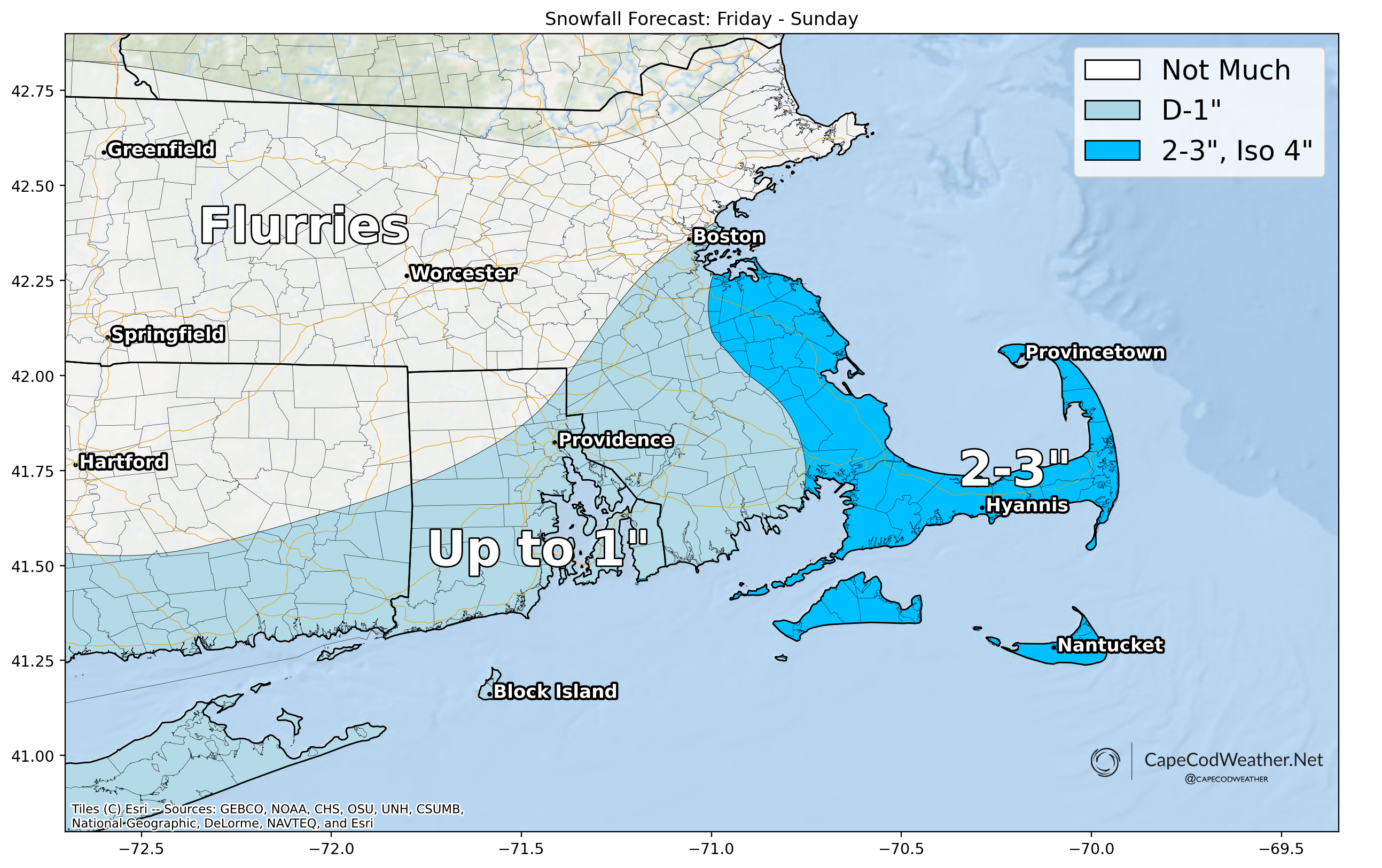
For Friday – light snow will develop during the midday / early afternoon hours and persist through the remainder of the day. Snow should fall lightly, but steadily, through the afternoon and into the early evening, yielding an inch or two of snow around the area. Snow should have no trouble sticking given the cold conditions and thus any untreated surfaces could be slick and snow-covered during the afternoon and evening. That said, it’ll be a light and fluffy snow – easy to sweep away and deal with.
Very cold air will pour into the area behind the departing ocean storm Friday night and linger over the area Saturday and Sunday. While things will dry out and clear out to start Saturday, winds aloft will have just enough of a northerly component to them that additional ocean effect snow showers and snow squalls are likely to develop on the Lower and Outer Cape later Saturday and into Saturday night. The strength and persistence of these snow showers and squalls will (obviously) dictate how much additional accumulation occurs over the second half of the weekend. For now, I’m thinking maybe another inch or two on the Lower and Outer Cape.
Overall – not a major winter weather event but the combination of temperatures stuck in the 20s, gusty winds and falling snow will certainly make for a very wintry weekend.