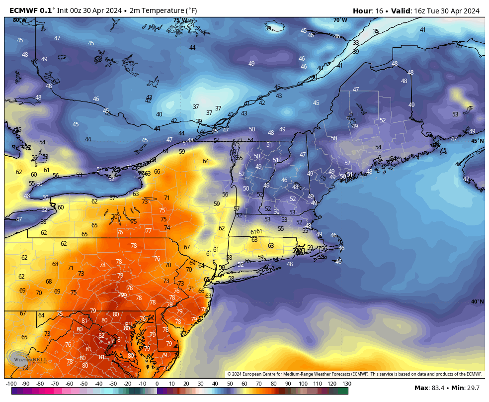
A surface boundary is draped north to south across New England today and this feature will remain in this general position for the better part of the next 5 days – oscillating around and making temperature forecasts quite challenging. To the east of the boundary, winds are blowing from an onshore direction and cool maritime air is pressing westward. Meanwhile, to the west, winds are coming from a mild southwesterly direction and full on spring is taking hold (think Monday’s weather). Unfortunately, it appears as though for much of the remainder of the week we will be on the wrong side of this frontal zone and forced to deal with onshore flow and cool temperatures.

