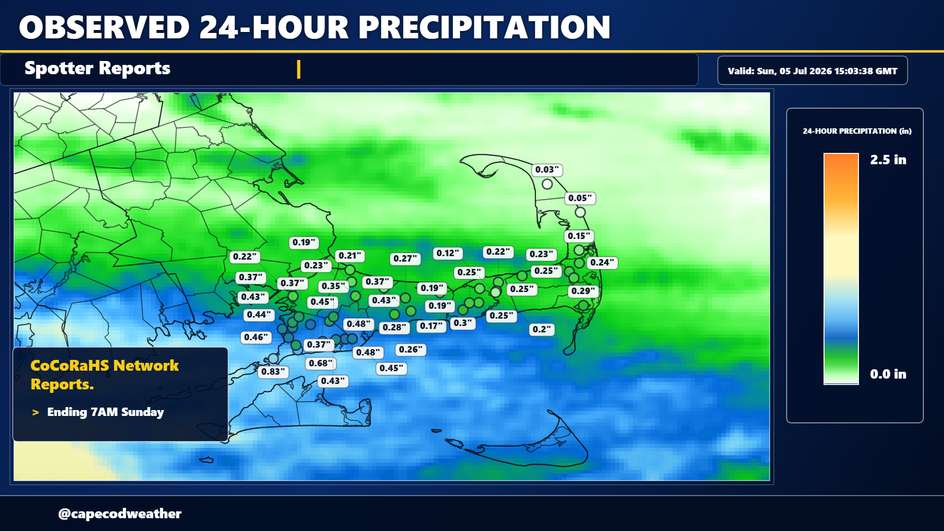
Powerful thunderstorms crossed over Connecticut Saturday evening, producing high winds, lots of lightning and some large hail (golf ball to tennis ball size!) in spots. That cluster of thunderstorms weakened as it pressed southeastward but held together enough to bring some rain to the Cape and Islands overnight. You can see on the spotter reports maps that the heaviest rain was furthest to the southwest (closest to the track of that thunderstorm complex) – over Woods Hole – with the lightest totals to the northeast over Truro and P-town where amounts were very light.