A strong winter storm will impact the area on Tuesday, bringing high winds, coastal flooding and heavy precipitation. Here on the Cape, the worst of the event is likely to be during the second half of the storm – Tuesday afternoon into Tuesday evening when strong NE winds combine with falling snow to create low visibility and tough travel around the area.
This is likely to be a very heavy/wet snow for several hours. That, combined with high winds and gradually falling temperatures, will likely mean some power outages around the area Tuesday afternoon.
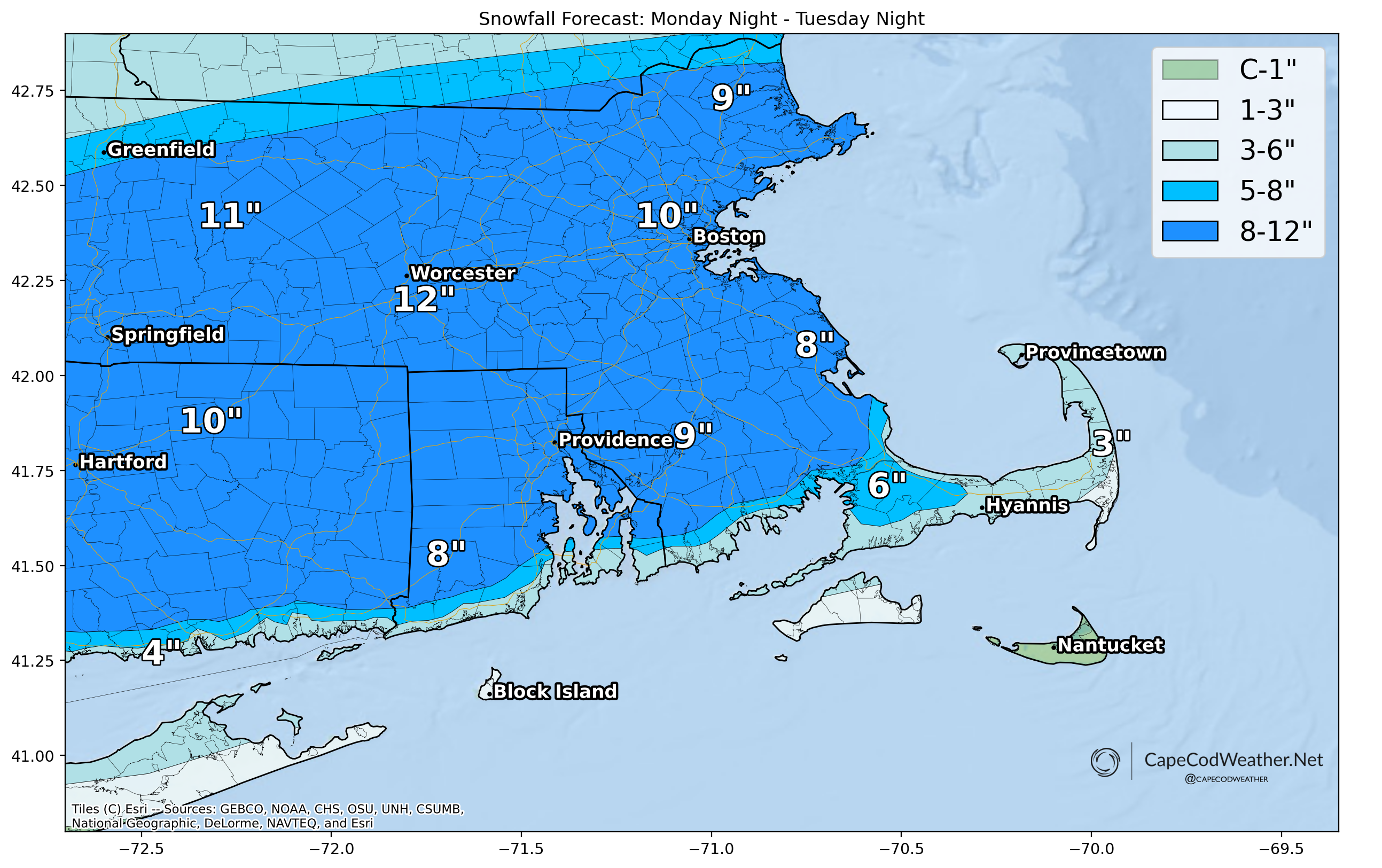
Above is a “first call” for snowfall amounts. Given that surface temperatures will be in the middle 30s through the first half of the storm and that precipitation will initially start as rain or a mix of rain and snow, amounts locally will be lower than interior locations where the snow will be lighter and fluffier and stack up far more easily.
Adjustments to the map may be necessary as details become more clear.