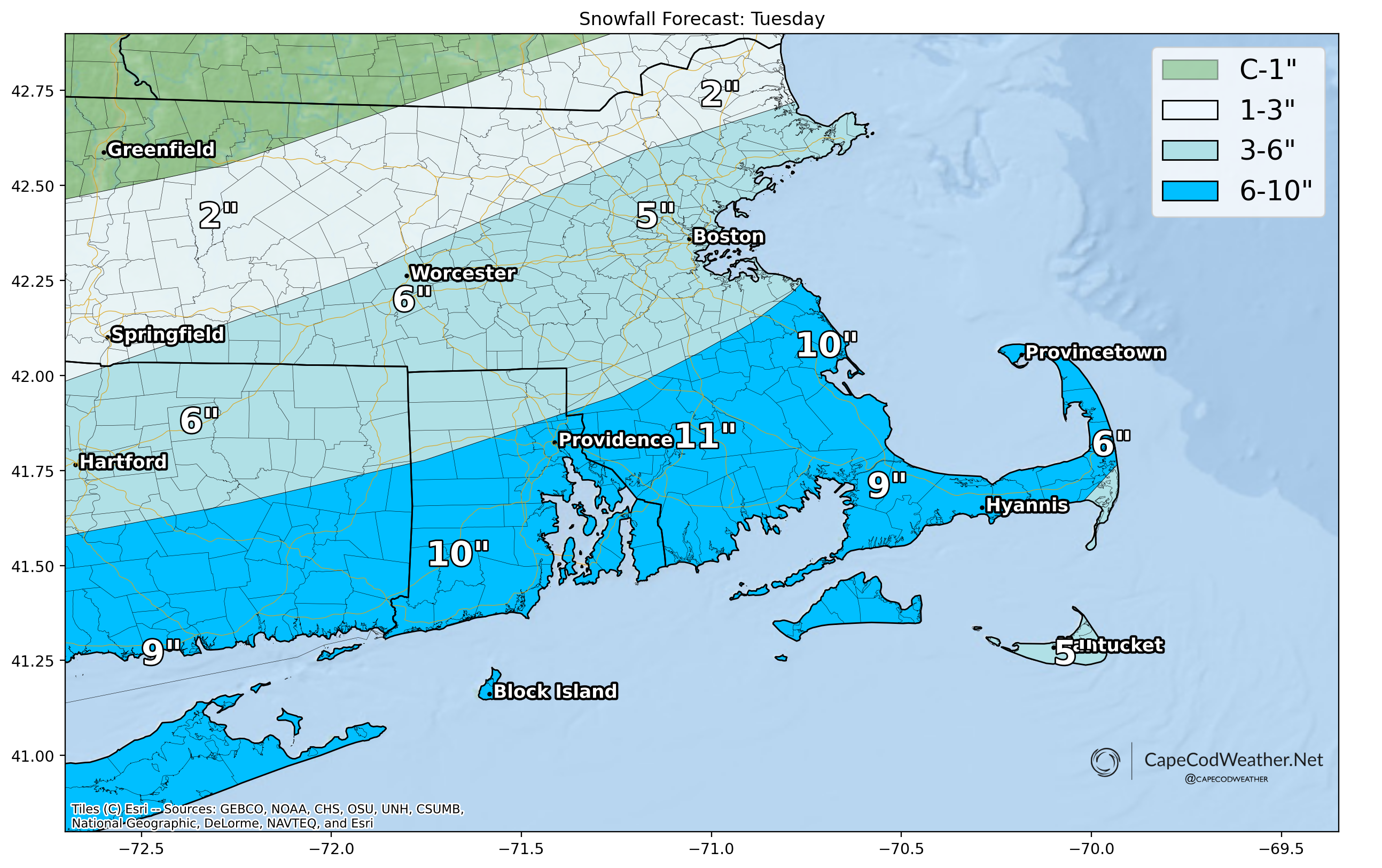
A fast-moving but hard-hitting winter storm will pass south of the region tomorrow, bringing us our biggest snow event in over 2 years.
A southerly jog to the storm track has decreased snow amounts to the north but resulted in more in the way of snow here on the Cape, with a general 5-10 inches of snow looking likely across our area.
Snow will be heavy and wet for a good chunk of the storm and is likely to be pasted onto everything – that, combined with strong N and NE winds is likely to bring down some limbs and power lines, resulting in isolated to scattered power outages throughout Tuesday afternoon.
Initially, temperatures both at the surface and aloft will be quite “warm” so precipitation may start as rain or a mix of rain and snow. However, as precipitation intensity increases and colder air is drawn into the storm, temperatures will cool and precipitation will flip to all snow. So don’t be surprised if it’s raining or just snowing and not accumulating when you get up Tuesday morning.
Travel is definitely going to be difficult Tuesday afternoon so just plan to hunker down and wait for things to clear out Wednesday.