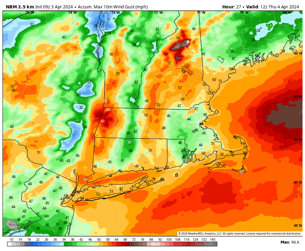
A large early spring low pressure center over the Great Lakes region today will gradually fill in and weaken as a secondary area of surface low pressure develops over the Mid-Atlantic region. This secondary storm center will deepen quickly through the day today and into tonight as it lifts up the coast and approaches Southern New England. Ahead of this strengthening secondary storm center, strong easterly winds will develop and pivot northward into our area, yielding a long night of howling east winds here on the Cape. Plan for frequent wind gusts of 50 to 65 mph around the area and scattered gusts of 65 to 70 mph. With precipitation falling as rain and no leaves on the trees, tree damage won’t be extreme but we can still anticipate some downed trees and limbs around the area and very likely some short-lived power outages. A High Wind Warning is posted.

