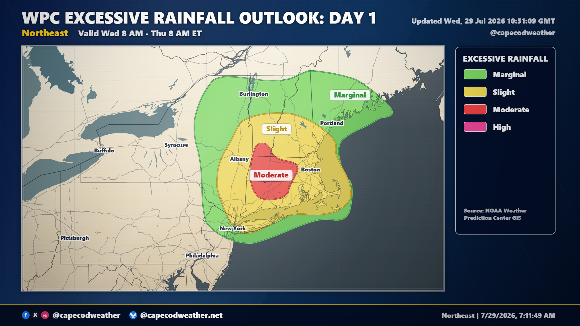
A slow-moving upper level low pressure center and its attendant surface low pressure(s) will wobble its way across the region over the next 24 hours. This storm system will act upon a warm and humid air mass to produce widespread heavy rainfall across a good chunk of the Northeast, with some locations over the interior likely picking up 5 to 10 inches of rain. Flash flooding is expected in spots, especially in eastern New York State and Western New England. Here on the Cape, we should dodge the heaviest of the rains but numerous showers and thunderstorms are still in the cards. Expect clouds to lower and thicken this morning and we will see wet weather overspread the are by midday at the latest. Some passing downpours are likely to move through the area today and tonight, which could lead to some short-lived street flooding. Monitor the radar through the day.