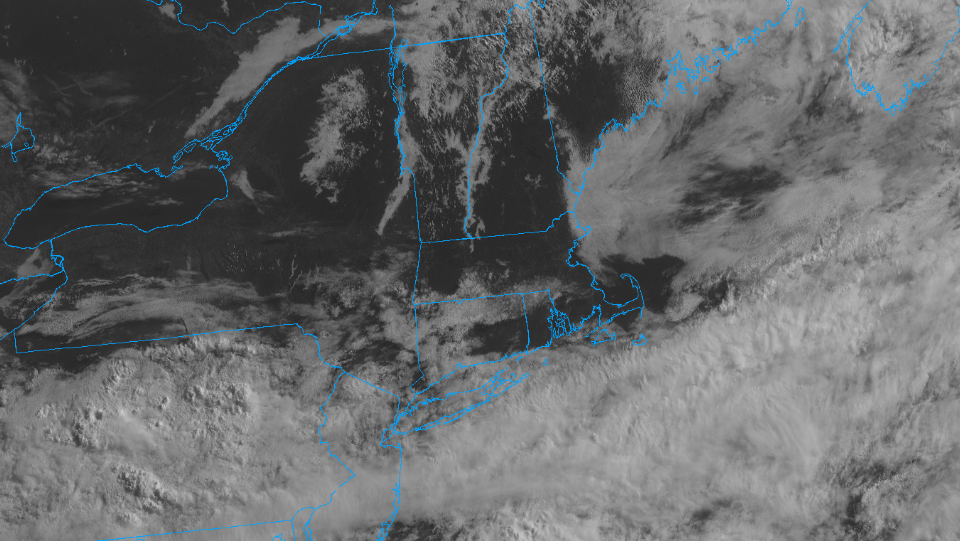
Throughout the week it was apparent that a cold front would stall out to our south Friday night and remain in place through Saturday. The forecast question all week was how much moisture associated with that front would linger across our region. Well you can see the that frontal zone very nicely on satellite imagery this morning. Notice the thick, west-to-east, band of cloud cover extending across the Mid-Atlantic to the waters just south and east of Cape Cod. Regional radar shows pockets of showers extending from Pennsylvania eastward across New Jersey and out into the waters of the Mid-Atlantic. Locally, cloud cover early Saturday morning shifted eastward and we’ve emerged into a nice pocket of blue sky and sunshine around the area. However, more pockets of cloud cover are lurking to our west and its likely that clouds will come and go through the day today. Additionally, just to the north of Cape Cod, an area of low clouds and fog is piled up against the coastline and that marine air is dropping southward toward the Cape. Consequently, despite the nice mid-morning weather, gray skies are likely to return at times today.